During the last fifty years, anthropogenic activities have increased dramatically, threatening marine coastal ecosystems. Managing these multiple pressures requires reliable data on their distribution and effects on sensitive habitats. Focusing on Posidonia oceanica beds, a threatened Mediterranean seagrass, we developed a statistical approach to analyse the relationship between human activities and ecosystem status.
Using Random Forest modelling across 1700 km of the French Mediterranean coast, we explained seagrass degradation (shift from bed to dead matte) as a function of depth and 10 anthropogenic pressures. The model was highly accurate, explaining 71.3% of the variance (Pearson correlation 0.84).
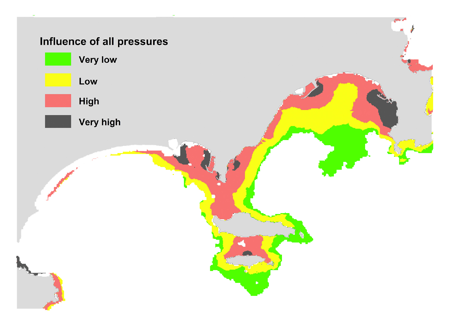
Key predictors included human-made coastline, depth, coastal population, urbanization, and agriculture, while aquaculture had low overall importance but strong local effects. Non-linear relationships revealed tipping points for all variables except agriculture and industrial effluents. These thresholds were used to map seagrass beds into four categories of increasing pressure and risk of phase shift, providing valuable insights for conservation and management.